File:The maximum extent of the Safavid Empire under Shah Abbas I.png
Jump to navigation
Jump to search
No higher resolution available.
The_maximum_extent_of_the_Safavid_Empire_under_Shah_Abbas_I.png (620 × 428 pixels, file size: 20 KB, MIME type: image/png)
Summary
| Description |
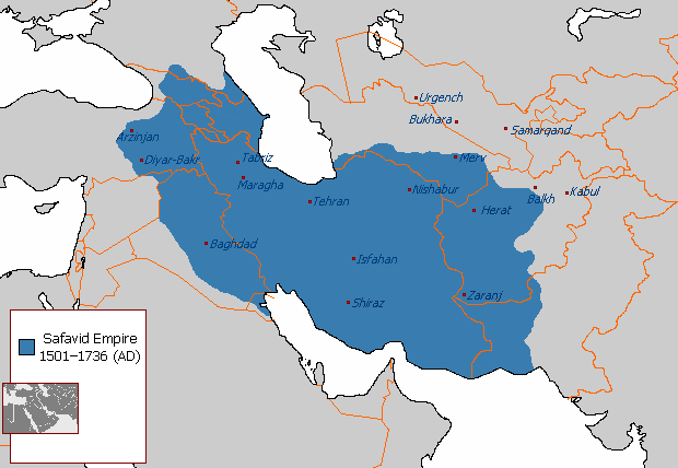
English: The maximum extent of the Safavid Empire under Shah Abbas I. فارسی: حداکثر وسعت امپراتوری صفوی در زمان شاه عباس یکم. |
||
| Source | File:Safavid_Empire_1501_1722_AD.png | ||
| Author | Arab_Hafez, edited by HistoryofIran (me). | ||
| Other versions |
|

Licensing
| This map is ineligible for copyright and therefore in the public domain, because it consists entirely of information that is common property and contains no original authorship. For more information, see Commons:Threshold of originality § Maps.
|
File history
Click on a date/time to view the file as it appeared at that time.
| Date/Time | Thumbnail | Dimensions | User | Comment | |
|---|---|---|---|---|---|
| current | 15:03, 1 January 2018 | | 620 × 428 (20 KB) | HistoryofIran | rv, take your concerns to the talk page |
File usage
The following 2 pages use this file: