This file is from Wikimedia Commons and may be used by other projects.
The description on its file description page there is shown below.
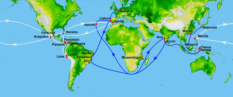
This is a retouched picture depiction of 16th century Portuguese and Spanish trade routes . The original can be viewed here: World Topography.jpg : Uxbona .
Public domain Public domain false false
Original upload log This image is a derivative work of the following images:
File:World_Topography.jpg licensed with PD-USGov-NASA-SRTM
2009-03-17T12:12:25Z Sk 21600x9049 (17145460 Bytes) {{Information |Description=PIA03395: World in Mercator Projection, Shaded Relief and Colored Height |Source=http://photojournal.jpl.nasa.gov/catalog/PIA03395 |Date=February 2000 |Author=NASA/JPL/NIMA |Permission={{PD-USGov- Uploaded with derivativeFX
English Add a one-line explanation of what this file represents
File history
Click on a date/time to view the file as it appeared at that time.
Date/Time Thumbnail Dimensions User Comment current 17:50, 15 July 2023 2,835 × 1,188 (2 MB) Hohum Brighten
File usage
The following page uses this file:
This file contains additional information, probably added from the digital camera or scanner used to create or digitize it.
If the file has been modified from its original state, some details may not fully reflect the modified file.


